
The Lucas Estate
LUCAS ESTATE MAPS 1838-1870
The Lucas estate in 1878, on the eve of Land Purchase, comprised 9,995 statute acres and was the sixth largest estate in the county (after Shirley 26,000, Bath 22,000, Dawson 17,000, Templeton 13,000, Hope 11,700).
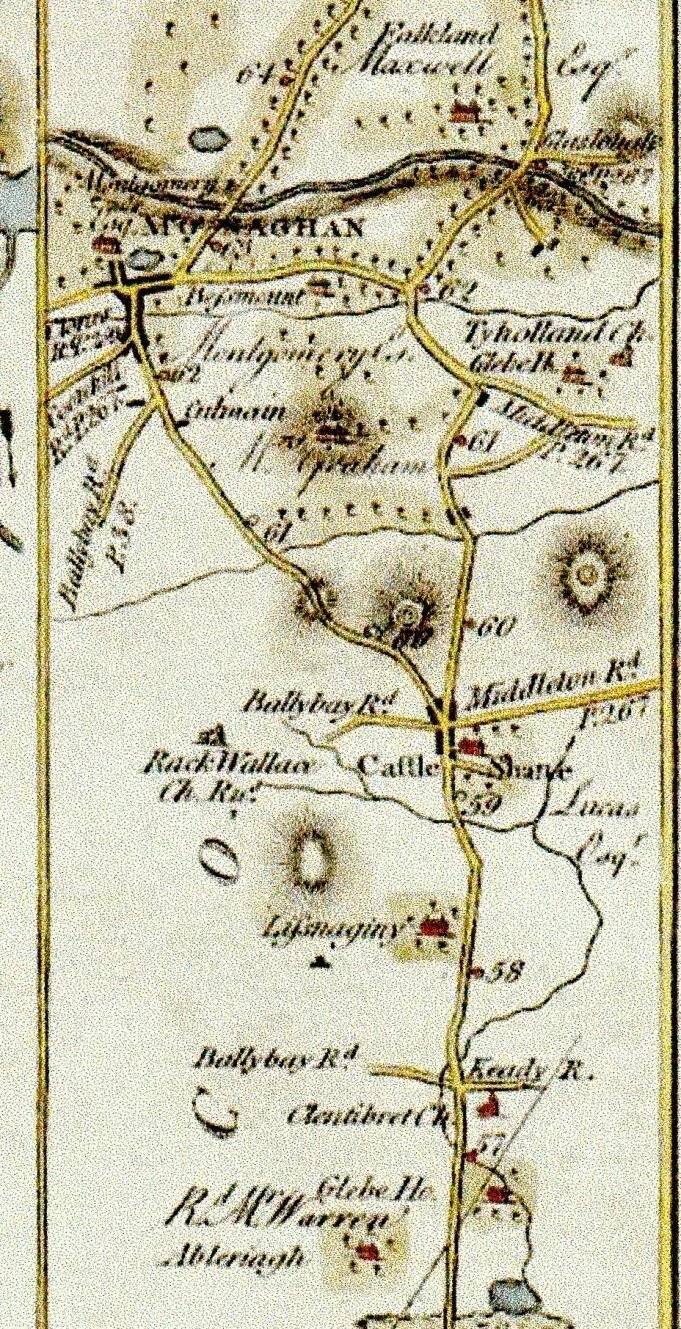
We have a very complete picture of the make-up of the estate in the nineteenth century thanks to the existence of estate maps which are now in the possession of Monaghan County Museum.
The maps were donated to the Museum following correspondence between Curator, Aiden Walsh, and the late Eamonn and Joe Smith, Moys in the early 1990s. Eamonn indicated that the Sherry family who were/had been in possession of the maps wished to donate them to the museum.
The maps are bound in embossed leather cover. In 2011 they were conserved and digitalised by the Museum. Size: approx. 24" x 18" landscape.
Title on outer front cover: CASTLE SHANE ESTATE MAPS 1870
The book comprises three sets of maps made by different cartographers, at different dates but obviously all bound at the same time, presumably 1870.
Maps by Robert Manning 1869
by Brassington and Gale 1838
by V. H. Smith May 1870
The amount of detail shown varies on each of the different sets of maps. The Brassington and Gale maps of 1838 are the most detailed. Field are numbered and coloured individually. Three colours are used: green, hatched pink, hatched blue. Farm boundaries shown in red, as are dwellings. Rivers are in blue. Field descriptions are shown e.g. Rich marl bottom, Pasture, Arable, Meadow, Furzy pasture, Rough furzy pasture. Specific feature such as steep slope, rock, orchard are noted.
The page facing each map has a detailed narrative for each holding giving name of occupier, acreage of each field with description e,g,, pasture, arable etc. and location of dwellings.
On Manning maps of 1869 reference numbers are to holdings. Fields are not numbered but acreage is shown on each field and the names of all occupiers and the acreage of their holdings are given.
Map no. 24 Greenmount and Tullycumusky is missing.
The estate maps show that the estate was made up as follows:
A. Mapped in 1838
Gortmore, Cortahert (Corrataghert), Drumsheeny, Moys Itra, Moys Otra, Lisgenny, Tullybuck, Lisglassan,, Brinletter, Cleran, Dromore.
Total area 1715Ac. 2Rd . 29Pr.
The first three townlands above are in the parish of Kilmore/Drumsnatt.
In Jan. 1860 in sales in the Landed Estates Court these three townlands are recorded as being sold by William B and Francis B Robinson – Cortahert to Mr Henry(in trust) and Gortmore and Drumsheeny to Mr Flemming.
Griffiths Valuations has Arthur G Lewis as owner of Gortmore South and Coretagahart (Cortahert?) , Samuel R B Evatt as owning Gortgmore North and W B Thomas as owner of Drumsheeny.
By 1879 these three townlands were in the ownership of H. O. Lewis Esq. (Shirley. Hist of Co. Monaghan)
The other eight correspond exactly with the tates disposed to Sr. St. John Broderick in the Downs Survey I the 1650s. These eight townlands are also shown as having changed hands in Jan. 1860 in the Landed Estates Court./ They were being sold as the estate of William B. and Francis B. Robinson.: Dromore, Lisglasson , Lissagenny and Moys Etra to Rt Hon. Edward Lucas; Brylitter to Mr Jos. Scott McMullen (check) ; Clerran to Mr Reilly,(Shirley gives the owner of Clerran in1879 as Lucas) Tullybuck to Mr Jones. The prices paid represented about £20 per acre.
So it appears that these eight townlands were not part of the original estate acquired by the wife of Francis Lucas in 1657, nor in the listed townlands granted by Charles 11 in 1683. They were part of the estate in 1838 but were being sold as part of the estate of the Robinsons in 1860 with Rt Hon. Edward buying them back.
B. Mapped in 1869 by Robert Manning:
Aghabrick, Cordevlisduff, Corskelly, Corwillan, Aughnameal,,Annyuby, Arclintagh,,Avelbane, Ballycranog, Creeve North, Ballygreny, Fintally, Castleshane Demesne, Carrickanure, Carrowkeel, Garron Otra or Gibralter, Paste, Clarderry, Cordevlisbane, Edenbrone, Corlagan north, Corlust, Cornabrandy, Downs, Cornamucklagh north, Creeve South, Moysnaght, Crossaghy, Derryellery, Dooskey (part of), Drumnart, Drumgolet, Feddans, Ferbane, Lisdrumdoagh, Glenahorn, Mullagarry,
Greenmount, Tullycumusky, Kingorry, Lattigar, Lismanin, Tyravrea, Letterbane, Letteragh, Lilsmagunshin, Listraor, Mullans, Pullans, Tirmacmoe.
Total area of these 50 townlands: 6650 Ac. 3 Rd. 22 Pr.
C. Mapped in 1870 by V.H. Smith:
Dundrumman - Parish of Clones. 219 2 14
This is Dundrumman which is in the present Catholic parish of Roslea. Much of the townland is bog. It was probably acquired by Lucas for the supply of turf. Shirley give the owner of Dundrumman in 1879 as Gould Lucas who was a son of Rt Hon Edward..
D. Mapped in 1870
Raconnell West, Tullycroman, Monaghan Duff otherwise Newgrove, Corknock, Raconnell East .
Total area: 500 Ac.
Lieutenant Colonel Robert Lucas, son of Edward Lucas (1720-1775) married Olivia Owen, co-heir of John Owen of Raconnell .
E. Maps from O.S. of Ireland titled:
Transfer of Property
Under Landed Estates Court
Townlands in Doohamlet and Annyalla area :
At bottom of map: "The location in which the estate of the Rt. Hon. Edward Lucas is situated is marked by a green colour."
Maps of these townlands follow:
Map 1. Drumgriston, Cordevlis, Corleanamady, Corlagan, Clonaneor
Map 2. Cornamuckla South, Dernaglug, Coreyloan
Map 3. Latnakelly, Drumgallan, part of Lisnagreeve
These 1870 maps for townlands in Annyalla and Doohamlet are ordnance survey maps, so there are no details of holdings or names of occupiers.
Area of A + B + C + D = 9126ac 2rd 19pr
The lands in E above would account for the remaining 770 acres (approx), making up the total estate of 9995 acres. (in approx. 80 townlands)
F Other holdings
Although not or included in the Estate Maps, the Griffith Valuations of 1861 give Rt. Hon. Edward Lucas as leasing the following townlands in the parish of Aughnamullen to teneants:
Creeve, Corlea, Cooltrim, Cortaghart, Lackan, Annyelkin, Drumgor, Aghnaskew.
Thanks to Theo McMahon for drawing attention to this.
However, in the records of the Landed Estate Courts, Rt. Hon. Edward Lucas is recorded, on November 5th 1861, as selling these townlands, except Creeve, as follows.
To Joseph C. Wright; Corlea, Lacken and part of Aghnaskew, total 634 ac., for £11,850
To James McWatty; Drumgor and Cooltrim, total 698 ac. for £11,550.
To James S. Hurtle: Annyelkin, 104 ac. for £1,540.
Writing in 1879,E.P. Shirley, wrongly it appears, gives the “present proprietor”of all eight of these townlands as Lucas.

Map of estate as detailed in Estate Maps

MAP OF CASTLESHANE DEMESNE
(Monaghan County Museum)
Of the 370 acres in Castleshane Demesne, the Castle, pleasure grounds, orchard and garden took up approx. 17 acres. 194 acres were in pasture and meadow land and 129 acres in plantation. The only tenant in the townland was James Wilson who held 16 acres in the “part called Lemnagore”.
The walled garden, farm buldings and bell tower have been preserved and restored andwere in the ownership of the late Mr Jim Cassidy.
The original entrance to the Castle had been from the Annaglough Road – the Monaghan Road entrance, with gate lodge, shown at top left of map.
The “Grand Entrance”, as it was known locally, from the present N2 road and the Gate Lodge were constructed about the time of the major rebuilding of the Castle in the early 1830s. Samuel Lewis writing in 1837 refers to the “handsome entrance lodge in the later English style of architecture, forming an interesting object as seen from the new line of road winding through the valley”. This is a confirmation also that the re-routing of the main Castleblayney-Monaghan road had only recently been done.
Census figures for 1841 indicate that there were 23 people living in 4 houses in the townland. In 1821 there were 7 Lucas family members and 11 servants in Castle Shane House.

Estate Map Tullybuck 1836 (Monaghan County Museum)

Detail of 1838 map of Tullybuck. Location later of school. Church, graveyard. Note McEneaney’s/Carson’s avenue.
(Monaghan County Museum)
THE NAME "CASTLESHANE"
The ringfort (map ref. 573) in Castleshane Demesne appears to be the place from which the name Castleshane originated. The estate map of 1869 shows the fort with the name "Shane's Fort". This version of the name of the fort would correspond with the popular local interpretation of the name Castleshane as "Shane's castle" and the assumption that this referred to the dwelling of a medieval Shane Mc Mahon on the site. However the explanation of the place-name which is now accepted as being more correct is that Shane comes from the Irish word síodhán (modernised to síán), meaning a fairy mound, and hence the present official Irish version of Castleshane being Caisleán an tSiáin.- the castle on the fairy mound.
The word "síán", or a version of it with this meaning occurs commonly in Irish placenames either on its own, as in Shane in Tullycorbet parish, or as part of a name.
The rounded hill to which we refer can be seen between the two entrances to the demesne on the Castleblayney road. The hill-top is heavily overgrown with untended woodland and invading laurel but traces of the existence of a ringfort can be seen. The seventeenth century Mc Mahon dwelling acquired by the first Lucas was a few hundred yards south of this, the site of the present castle.
(Houses of Monaghan - Irish architecture online - says the original house on the site was constructed in 1591). It is interesting that a map from 1778 shows the house on the eastern side of the main Monaghan Castleblayney road, not to the west as at present. This is evidence of the route of the roadway, not the location of the house, having been changed.
Taylor & Skinner 1777 (UCD Map Collection)
EARLIEST SETTLEMENTS
An Archaeological Inventory of County Monaghan compiled by Anna Brindley and published by the Statistics Office details evidence of ringforts, souterrains and other earthworks, which are the earliest traces of human habitation on the Irish landscape.
These settlement sites are believed to have been built mainly in the early Christian period (500 - 1000 AD). The larger, more dominant raths or forts would have been the dwellings of the main land-owning Gaelic chieftains with the smaller, usually more low-lying ringforts belonging to subservient land-holders.
The map (see map 6) identifies ringforts in the Castleshane area as follows
Map ref.
Cavancreevy 217, 218
Garron Itra 296
Garron Etra 297
Tiravray 1116
Limenan 452
Cordevlis (Duff) 615
Cordevlis (Bane) 234
Fedoo 829
Castleshane Demesne 573, 408
Corlust 383
Lisaginny 932, 173 ringfort and souterrain
Lisglasson 956, 957
Mullans 188 possible souterrain
Drumgolet 753, 167 ringfort and souterrain
Drumbeo 272
Listinny 1005
Dooskey 265,421, 715
Annahuby 518
Legnacrieve 325, 326, 923
Creeve 680
Avelreagh 77 crannog (in former unnamed lake)
Traces of many of these can still be seen. In Castleshane Demesne, at site 408 the circular embankment and ditch is clearly identifiable for most of its circumference. 573 is the site of Siain from which the name Castleshane originates. It is less easily visible, being heavily overgrown.Interestingly, the Lucas estate map of the demesne identifies it as Shane's Fort probably an indication that the cartographer and the Lucas in possession in 1840s (?) were unaware of the Irish origin of the name.


Remains Of the Ringfort in Castleshane Woods


The waterfall in Castleshane woods